

Close Menu
Stratnews GlobalStratnews Global
    Facebook X (Twitter) Instagram
    Trending
    • China’s Cyberbullying Law Targets AI Abuse
    • Shield AI Thunder Tiger Partnership Expands Maritime AI
    • Chandrayaan-3 Findings Link Moon Site to Lunar Meteorite
    • Geostationary Orbit Debris Raises Satellite Collision Risk
    • Vikram-1 Launch: Can India Replace Satellites Faster?
    • Technology-Driven Warfare Redefining National Security
    • Frontier Technologies to Shape India’s Future Growth
    • Shubha Venkatesh Iyengar’s Technology Guides Flights
    • Support Us
    Stratnews GlobalStratnews Global
    Write for Us
    Wednesday, July 29
    • Space
    • Science
    • AI and Robotics
    • Industry News
    • Support Us
    Stratnews GlobalStratnews Global
    Home » UK Space Weather Monitors Aim to Protect Aircraft and Satellites

    UK Space Weather Monitors Aim to Protect Aircraft and Satellites

    Aishwarya ParikhBy Aishwarya ParikhNovember 27, 2025 Space No Comments2 Mins Read
    UK Space

    Understanding the New Space Weather Project

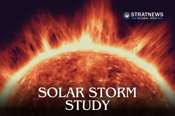
    The University of Surrey’s Space Centre has joined forces with the UK Met Office to improve monitoring of solar storms that can threaten aircraft, satellites, and power grids. Together, they have launched new space weather monitors designed to better understand how solar activity affects Earth’s upper atmosphere.

    These Surrey-built radiation sensors were carried to altitudes above 100,000 feet (around 30 km) on weather balloons. The launches took place at Met Office sites in Camborne, southwest England, and Lerwick in Shetland, as well as in De Bilt in the Netherlands with the Royal Netherlands Meteorological Institute (KNMI). The initial flights on 17 October served as proof-of-concept tests, comparing balloon readings with new ground-based monitors installed earlier this year.

    Gathering First-of-Its-Kind Data

    Dr Ben Clewer from the University of Surrey explained that the system measures the radiation environment by tracking the number and type of particles that pass through it. These measurements are then converted into dose rates used for radiation protection.

    The collaboration proved timely, following an X-class solar flare on 11 November that triggered one of the strongest atmospheric radiation increases in about two decades. During this event, Met Office teams quickly deployed sensors, collecting unprecedented data. “We believe we’ve gathered the first radiation measurements during a solar storm from ground level to 100,000 feet and back, something never done before,” Clewer said.

    Enhancing Space Weather Models

    Met Office Senior Space Weather Manager, Krista Hammond, noted that the data is still being analysed but early results look promising. “This information will be valuable for improving our models, helping us better understand radiation levels in the atmosphere,” she said.

    Solar eruptions can send bursts of charged particles and magnetic fields towards Earth, disrupting satellites, communication systems, and aviation. Hammond added that as technology becomes more critical to daily life, awareness of space weather impacts has grown.

    The balloon-based instruments will now supply live measurements to Met Office models that estimate radiation doses both in normal conditions and during rare “ground level enhancements”, when solar particles penetrate deep into Earth’s atmosphere.

    Dr Clewer warned that these events could become more frequent during the Sun’s current peak activity period. “We’re trying to prepare the world for such events so that our critical infrastructure remains safe,” he said.

    with inputs from Reuters

    Author

    • Aishwarya Parikh
      Aishwarya Parikh
      View all posts
    Featured
    Share. Facebook Twitter Pinterest LinkedIn Tumblr Email Reddit Telegram WhatsApp
    Aishwarya Parikh

      Keep Reading

      China’s Cyberbullying Law Targets AI Abuse

      Shield AI Thunder Tiger Partnership Expands Maritime AI

      Chandrayaan-3 Findings Link Moon Site to Lunar Meteorite

      Geostationary Orbit Debris Raises Satellite Collision Risk

      Vikram-1 Launch: Can India Replace Satellites Faster?

      Technology-Driven Warfare Redefining National Security

      Add A Comment
      Leave A Reply Cancel Reply

      Anti Drone System (CUAS)
      Latest Posts

      China’s Cyberbullying Law Targets AI Abuse

      July 29, 2026

      Shield AI Thunder Tiger Partnership Expands Maritime AI

      July 29, 2026

      Chandrayaan-3 Findings Link Moon Site to Lunar Meteorite

      July 29, 2026

      Geostationary Orbit Debris Raises Satellite Collision Risk

      July 29, 2026

      Vikram-1 Launch: Can India Replace Satellites Faster?

      July 29, 2026

      Technology-Driven Warfare Redefining National Security

      July 28, 2026

      Frontier Technologies to Shape India’s Future Growth

      July 28, 2026

      Shubha Venkatesh Iyengar’s Technology Guides Flights

      July 28, 2026

      China DUV Lithography Machines Enter Production

      July 28, 2026

      Machine Identities Drive New Enterprise Security Challenge

      July 28, 2026

      Subscribe to News

      Get the latest sports news from NewsSite about world, sports and politics.

      • Astronomical Events
      • Space Missions
      • Industry News
      • Science
      StratNewsGlobal Tech
      Facebook X (Twitter) Instagram LinkedIn YouTube
      © 2026 StratNews Global, A unit of BharatShakti Communications LLP
      • About Us
      • Contributors
      • Copyright
      • Contact
      • Write for Us

      Type above and press Enter to search. Press Esc to cancel.