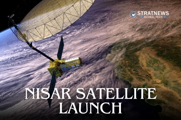
In a landmark moment for international space cooperation, the NISAR satellite, a joint mission between NASA and the Indian Space Research Organisation (ISRO) is expected to launch later this month from ISRO’s Satish Dhawan Space Centre in Sriharikota.
The mission represents the most advanced Earth observation partnership ever undertaken between the United States and India.
The NASA-ISRO Synthetic Aperture Radar (NISAR) satellite will provide a sweeping, high-resolution, three-dimensional view of Earth’s surface, offering unmatched detail on natural and human-induced changes across the planet.
A Leap in Earth Observation Technology
NISAR is equipped with two sophisticated radar systems: L-band from NASA and S-band from ISRO. This dual-frequency setup allows the satellite to observe changes in the Earth’s surface as small as a few centimeters, regardless of cloud cover or weather conditions.
By scanning nearly the entire globe every 12 days, NISAR will monitor dynamic processes such as glacier movements, land subsidence, earthquakes, floods, and agricultural changes. The data collected will enhance early warning systems for natural disasters and help guide climate adaptation strategies worldwide.
“This mission is going to fundamentally transform how we understand Earth’s systems,” according to a space expert. “From shifting tectonic plates to the moisture content of farmlands, NISAR will be our eye in the sky for planetary health.”
ISRO’s Crucial Contributions
While NASA leads the U.S. component of the project through its Jet Propulsion Laboratory (JPL) in California, ISRO is playing a vital and multifaceted role in making this mission a reality.
ISRO has delivered:
The S-band radar system, developed at the Space Applications Centre.
The spacecraft bus, built at the U R Rao Satellite Centre in Bengaluru.
The GSLV launch vehicle, developed at the Vikram Sarabhai Space Centre.
Launch services from the Satish Dhawan Space Centre.
Mission operations and data handling through the ISRO Telemetry Tracking and Command Network (ISTRAC) and National Remote Sensing Centre (NRSC).
This collaboration not only showcases ISRO’s growing technical prowess but also reinforces India’s rising profile in global space science.
Global Impact and Scientific Legacy
The launch of NISAR comes at a time when nations are racing to gather more accurate data about Earth’s rapidly changing ecosystems. The satellite’s data will be open-access, supporting researchers, policymakers, and first responders worldwide.
Its ability to peer through clouds and observe ground movement makes it particularly useful in disaster zones, where conventional satellites might be obstructed. During events such as hurricanes, landslides, or volcanic eruptions, NISAR will provide critical, real-time insights that could save lives and infrastructure.
Beyond crisis response, the satellite will track long-term changes in forests, wetlands, glaciers, and urban development, offering a valuable tool for addressing climate change and sustainable land use.
Liftoff and Live Coverage
The launch, scheduled for late July, will be streamed live by NASA’s Jet Propulsion Laboratory on their different social media platforms.
A Turning Point in Space Diplomacy
NISAR marks the first time the two space agencies have jointly developed and launched a satellite of this scale. As geopolitical alliances shift and climate challenges intensify, this mission represents more than scientific progress—it’s a symbol of cooperation in an increasingly divided world.
As the countdown begins, all eyes will be on Sriharikota, where a bold new chapter in Earth observation is about to begin.


