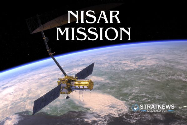
India and US to Launch Advanced Earth Observation Satellite NISAR
India and the United States are set to launch NISAR, one of the most advanced Earth observation satellites ever developed. Scheduled for lift-off on July 30, the NASA-ISRO Synthetic Aperture Radar (NISAR) mission represents a major step forward in space collaboration, coming exactly 50 years after the SITE project.
This landmark mission will scan the Earth every 12 days, capturing radar data with unmatched precision. Each pixel from NISAR’s radar will represent an area about half the size of a tennis court. It will track changes in land, water, ice, and vegetation with accuracy down to a few centimetres.
Jointly Built for Global Benefit
This is the first satellite jointly built by NASA and the Indian Space Research Organisation (ISRO). NASA has provided the L-band radar, while ISRO contributed the S-band radar and will handle the launch. This dual radar system allows NISAR to capture both surface-level and deeper sub-surface changes, even through clouds or at night.
“This technology lets us measure ground displacement to millimetre-level precision,” said Paul Rosen, project scientist at NASA’s Jet Propulsion Laboratory. “It’s like watching Earth in motion, frame by frame.”
The data from NISAR will be freely available to scientists. It will be used to predict floods, monitor coastlines, assess crop damage, support ship tracking, and respond faster to disasters.
From SITE to NISAR: A 50-Year Journey
The NISAR mission follows in the footsteps of the 1975 SITE project, when NASA’s ATS-6 satellite beamed educational content to over 2,400 Indian villages. Launched during India’s Emergency period, SITE reached nearly 200,000 people, trained 50,000 teachers, and supported farmers with practical advice.
“Fifty years ago, NASA helped us educate rural India,” said Arup Dasgupta, former deputy director of ISRO. “Today, we’re launching a satellite together.”
A Precision Tool for a Changing Earth
NISAR will monitor the Himalayas, glacial lakes, forests, farmland, and even coastlines around the globe. Its data will help track glacier evolution and assess risks like glacial lake outburst floods (GLOFs) in the Himalayan region.
According to Prof PG Diwakar of the National Institute of Advanced Studies, the L-band radar can see through dense forest canopies to measure biomass, making it essential for environmental studies and conservation.
“This is the first dual-band SAR in space,” Diwakar noted. “It opens up detailed studies of ground movement, seismic activity, and environmental changes.”
NISAR will also help detect oil spills and other hazards with high accuracy, strengthening disaster preparedness worldwide.
Continuing a Legacy of Innovation
NISAR draws inspiration from Seasat, NASA’s 1978 mission that carried the first spaceborne SAR. Though Seasat lasted just 105 days, it revolutionised Earth observation science.
With a planned life of at least three years, NISAR will send down more data daily than any earlier satellite. “This is the first Indo-US satellite mission to observe the planet in such rich detail,” said Nicola Fox, associate administrator at NASA’s science directorate.
India leads the launch, enhancing its scientific standing. NASA extends its commitment to Earth science. Together, the two nations have built a satellite that does more than take pictures—it tells the planet’s story in real time.


