


NASA Tool Turns Earth Into Personalised Names
NASA has introduced an interactive feature that allows users to create their names using satellite imagery of Earth. Known as “Your Name in Landsat”, the tool blends scientific data with creative expression, offering a unique way to engage with Earth observation technology.
Launched around Earth Day 2026, the feature enables users to input their names and instantly generate a visual representation formed entirely from natural landscapes. Instead of conventional fonts, each letter is shaped by real geographical features such as rivers, coastlines, forests, and deserts.
How Natural Landscapes Form Letters
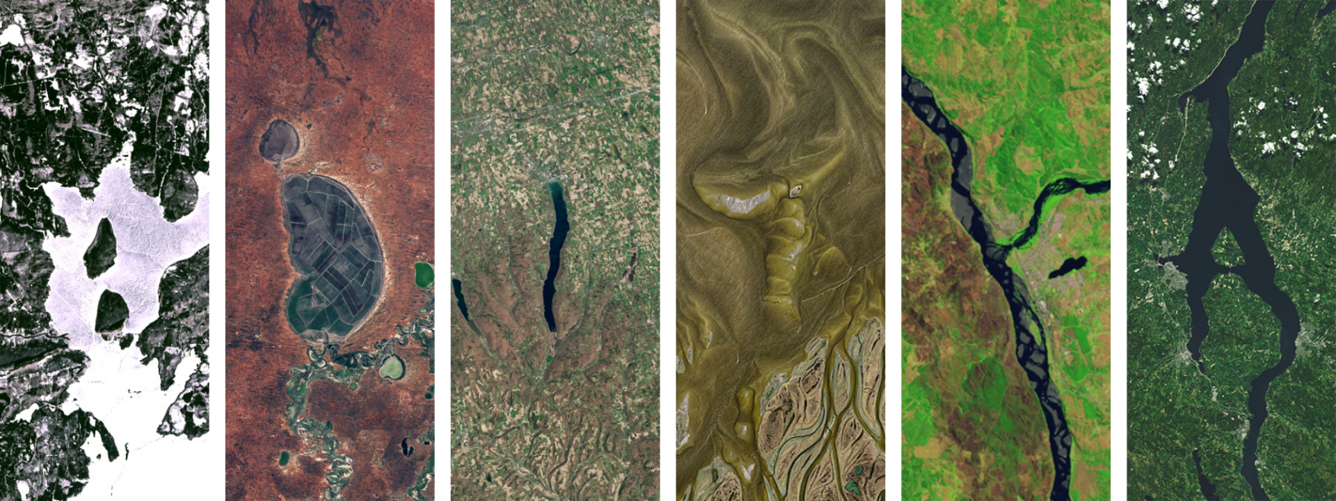
The system operates through advanced pattern recognition. It scans a vast archive of satellite imagery and identifies natural formations that resemble alphabet shapes. For example, a winding river may form the shape of an “S”, while a curved coastline can resemble a “C”. Similarly, agricultural patterns may align to create letters such as “E”.
Importantly, these shapes are not artificially designed or altered. Each letter comes from genuine Earth imagery captured over time. Once the name is generated, users can view, download, and share their personalised creation.
Built On Decades Of Earth Observation
The tool is powered by the Landsat programme, one of the longest-running Earth observation missions. Managed jointly by NASA and the U.S. Geological Survey, Landsat has been continuously capturing images of Earth since 1972.
This extensive archive includes data on forest cover, urban growth, water systems, and agricultural patterns. Over the years, it has become a critical resource for monitoring environmental changes, including climate trends, deforestation, and urban expansion.
Blending Engagement With Education
Although the feature offers a playful user experience, it also serves a deeper purpose. By allowing individuals to see their names formed from Earth’s landscapes, NASA makes complex scientific data more accessible and relatable.
At the same time, the tool highlights the importance of Earth observation. The same datasets used to create personalised images are essential for scientists and policymakers studying environmental change and planning sustainable solutions.
Bringing Space Technology Closer To People
“Your Name in Landsat” demonstrates how space-based technology can be both meaningful and approachable. It transforms decades of scientific data into a visually engaging and personal experience.
Through this initiative, NASA connects people more closely with the planet while showcasing the value of long-term Earth observation. The result is a creative yet informative tool that brings science into everyday life in a compelling way.